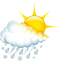
Ischgl

Wetter

Subtitle

Weather today

Temperature
5 °C / 21 °C
Sunshine hours
9 h
Weather icon
Weather morning
Temperature
5 °C
Rain probability
0 %
Wind direction
W
Wind force
7 km/h
Snow fall border
3000 m
weather.overview.weather-icon-4
Weather afternoon
Temperature
21 °C
Rain probability
30 %
Wind direction
SW
Wind force
7 km/h
Snow fall border
2900 m
weather.overview.weather-icon-2
Friday, 02.05.2025
Temperature
8 °C / 23 °C
Rain probability
5 %
Wind direction
SW
Wind force
11 km/h
Snow fall border
3100 m
weather.overview.weather-icon-3
Saturday, 03.05.2025
Temperature
11 °C / 21 °C
Rain probability
5 %
Wind direction
SW
Wind force
23 km/h
Snow fall border
3100 m
weather.overview.weather-icon-11
Sunday, 04.05.2025
Temperature
10 °C / 18 °C
Rain probability
60 %
Wind direction
SW
Wind force
21 km/h
Snow fall border
2700 m
weather.overview.weather-icon-20
Monday, 05.05.2025
Temperature
6 °C / 12 °C
Rain probability
75 %
Wind direction
NW
Wind force
11 km/h
Snow fall border
1950 m
weather.overview.weather-icon-19
Tuesday, 06.05.2025
Temperature
3 °C / 13 °C
Rain probability
55 %
Wind direction
SW
Wind force
14 km/h
Snow fall border
1950 m
weather.overview.weather-icon-19
Wednesday, 07.05.2025
Temperature
4 °C / 13 °C
weather.overview.weather-icon-20
Thursday, 08.05.2025
Temperature
4 °C / 14 °C
Ischgl

WINTERSPORT

Aktiv
The weather-determining high will once again provide the finest early summer weather on Friday. The zero degree limit rises to 3500m above sea level. Once again, only a few harmless cumulus clouds will join the bright sunshine. At the weekend, the influence of the high pressure will weaken, but a cold front will bring more foehn-like south-westerly winds, which will continue to bring us warm and quite friendly weather conditions. Saturday in particular promises stable and dry conditions all day long. The sun will also prevail on Sunday. It will remain foehn-like and the risk of showers in the unstable stratified air will slowly increase as the day progresses. At the beginning of the new week, a cold front will lie over our region and cause cloudy and partly wet weather. It will cool down and the snow line will drop towards 2000m above sea level. The weather will then remain cool and unsettled. The ice saints are likely to arrive a little early in the country this year.
Ischgl

AKTUELLE WETTERWERTE

Subtitle
Name Altitude Temperature Wind force Webcam
Alblittkopf
2.700 m 6 °C 14 km/h
Diasbahn Bergstation
Open webcam
1.830 m 14 °C 2 km/h
Kappl
1.180 m 0 °C -

Lorem ipsum dolor sit amet, consetetur sadipscing elitr, sed diam nonumy eirmod tempor invidunt ut labore et dolore magna aliquyam erat, sed diam voluptua. At vero eos et accusam et justo duo dolores et ea rebum. Stet clita kasd gubergren, iam voluptua. At vero eos et accusam et justo duo dolores et ea rebum.

Avalanche warning

2 Moderate

2 Moderate
The avalanche warning level refers to the Kappl ski area
divider divider
Test
01
Ischgl

WINTERSPORT

Aktiv
divider divider
Card Teaser Slider
02
Take part and win!

Take part in our survey and with a little luck win a holiday in Austria!